Love Canal, sounds great. Valley of the Drums, why not? Burnt Fly Bog, what more could you need?
These are all names of superfund sites in the US. Superfund sites are places where hazardous waste has been dumped and left unmonitored.They can be found at processing plants, landfills, mining sites, and manufacturing facilities. Superfund itself is the Comprehensive Environmental Response, Compensation and Liability Act (CERCLA), which was established by Congress in 1980.
According to the EPA, Superfund “allows EPA to clean up contaminated sites. It also forces the parties responsible for the contamination to either perform cleanups or reimburse the government for EPA-led cleanup work”.
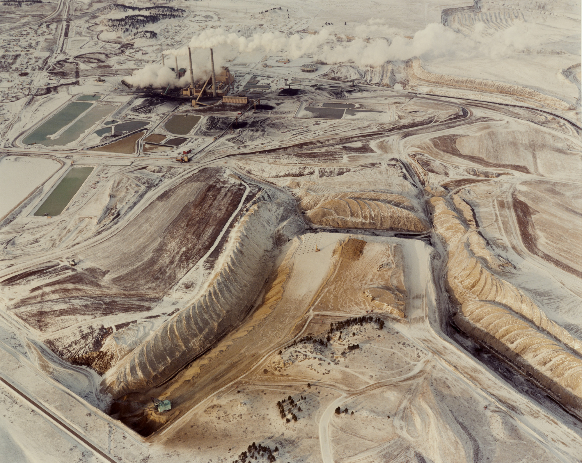
Photographer David T. Hanson actually took pictures of Superfund sites
from 1985 to 1986. He aimed to take pictures of sites all across the
country to get a wide variety to demonstrate how they are affecting the
landscape.
For many sites he has photographed, Hanson had to rent a plane and a pilot to fly him over the site. Sometimes he was required to be 200 feet above the ground all the way to 2,000 feet. Hanson was able to photograph 67 of the most dangerous sites on the National Priorities list, but there are still many out there. According to Fortune, in 1980 there were “400,000 toxic waste sites and 500,000 abandoned mines across the U.S”.
If you are interested in getting a closer look to where certain sites are located in the US, check out the National Geographic website which includes an interactive map can show sites near you.
https://www.nationalgeographic.com/superfund/#charts
Sources:
https://www.epa.gov/superfund
https://www.epa.gov/superfund/search-superfund-sites-where-you-live
https://fortune.com/2018/10/30/aerial-photos-superfund-sites-usa/


I find this so interesting because the government and politicians typically don't mention these superfund sites. From your post, it's evident that they're certainly catastrophic, and most likely very difficult to remove and contain. I found that the largest superfund site is in Butte, Montana, and it's incredibly toxic. A flock of geese flew through the superfund site one year and 342 died within two days. All of them died almost immediately from drinking the water at the site, as it burned the goose from the inside out. Even though cleanup actions are ongoing thousands of birds still die here each year. Perhaps more government and political attention towards the sites would raise awareness, thus incentivizing more immediate/effective actions taken to clean them.
ReplyDeletehttps://fortune.com/2018/10/30/aerial-photos-superfund-sites-usa/
I personally found the photography of these Superfund sites very interesting and wanted to research other photos that had major public impact in the environmentalism movement. One of the earliest and most iconic images during this movement was called Earthrise, and was taken on the Apollo 8 space mission in 1968. This photo itself was taken by astronaut Bill Anders and features the Earth from the perspective of the moon. As noted by the astronauts, "It didn’t take long for the moon to become boring. It was like dirty beach sand." However, the astronauts "suddenly saw this object called Earth," a colorful and fragile planet in the middle of an empty sky. This message echoed through the American public, causing many to realize the brilliance and importance of the planet we live on.
ReplyDeletehttps://www.theguardian.com/science/2018/dec/24/earthrise-how-the-iconic-image-changed-the-world
It's great that you also wrote about superfund sites and specifically brought to light the devastating impact these chemicals have through pictures. Upon further research I learned that climate change is putting 60% of these superfund sites at risk. "At least 945 toxic waste sites across the country face escalating risks from rising seas, more intense inland flooding, voracious forest fires and other climate-fueled disasters, according to a new study from a congressional watchdog agency." Flooding would be specifically bad because these terrible chemicals and pollutants could be spread everywhere in communities like in Hurricane Katrina where the lead in paint on houses became a huge problem.
ReplyDeleteSource:
https://www.washingtonpost.com/climate-environment/2019/11/18/about-percent-superfund-sites-could-be-hit-by-climate-change-new-government-report-finds/
I think that this post is very interesting and the pictures really help us get an idea of what these superfund sites really were. As mentioned, during the 1980's, there existed many superfund sites. Valley of Drums is a 23-acre waste site in Kentucky and was named because of the drums left across the area. It caught attention in 1966 when the drums caught fire and burned for more than a week. It was only in 1983 when the clean up began and it took until 1990 to finish.
ReplyDeleteSource:
https://en.wikipedia.org/wiki/Valley_of_the_Drums